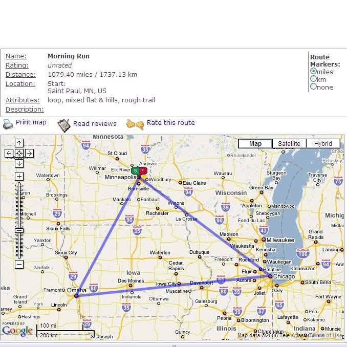
for instance if i want to go on one of my usual routes before work, i start from downtown st paul and merge onto 35e going south to kansas city then i turn up towards chicago before circling back home again. to save time i cut across countless fields and yards. but you can see from the map that i cover about 1080 miles. (im trying to build my base) i really love the days when i have a running parter because then we can use the carpool lanes when available.

it couldnt be easier to use. start by entering the zip code of the area where you want to run then zoom in on the map and start clicking points you want to run to. it will give you distances across fields, down trails, through yards and everywhere else you may want to go. there are options to view your route as a satellite image if you prefer to see landmarks or trails that arent visible on the map.
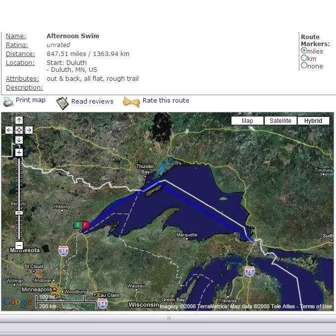
as a super bonus i use it to measure my open water swims. ploting distances between beaches lets me know exactly what i swam and its much better than counting laps at the y! here is an example of a workout i may do after work. its an out and back swim just shy of 850 miles. as you can see i swim from duluth up towards thunder bay and then along the us/canada border until i hit sault ste marie in nothern michigan. once i hit the shipping lanes i can usually find a cargo ship to draft off of. and as an added bonus there is a water fountain right near the shore where i can take a quick drink before heading back.

now if i was to do that at the pool that would be about 29,920 laps. i cant keep track of that. my brain gets tired just thinking about it!
if you dont have the time to do one of these proper workouts then you can just as easily use the usatf map to plot your run through your neighborhood and chart your swim at a local lake. i hope you will take advantage of this useful tool when planing your next workout.


3 comments:
That's as far as you can run before work? You pansy.
There's another one at http://gmap-pedometer.com that I use. And if you use the training log at buckeyeoutdoors.com, there's another that ties in with your log.
WHat up crazy? I copied you. You can check out my triathlon-ing blog at
http://drtoxic.blogspot.com/
Do you like star wars? Do you like Triathlons? Check it out!!!
Post a Comment